Snow Storm Tracking using GIS
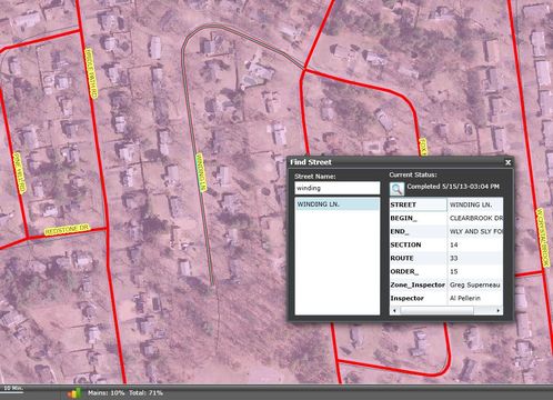
Detailed information supplied by in-the-field inspectors gives an overview of the progress in each section of the City. Streets in blue are reported as plowed where as streets in red are not plowed. Information provided by the map enables plows to be redeployed to sections of the City getting done slower. Snow Control is also able to use the map to handle call from residents as to specific information about there street.