The Connecticut River Walk & Bikeway Initiative
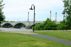
The first sections of the Connecticut River Walk and Bikeway, a 3.7 mile segment in Springfield and a 1.7 mile segment in Agawam, are now open to the public. For most of its proposed 20-mile corridor, the River Walk will run immediately adjacent to the banks of the Connecticut River, passing through a continuous greenbelt and offering majestic river views. Much of this area is publicly-owned municipal flood control land. Where a riverside route is unfeasible, connections will be made through bike lanes added to town and city streets.
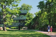
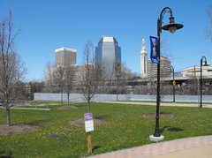
The longest river in New England, the Connecticut River is the Pioneer Valley’s most prominent natural asset. For centuries it’s been a source of regional identity and pride. But in recent times we’ve been cut off from the river by flood control dikes, railroad tracks, Route 5 and Interstate 91. The Connecticut River Walk & Bikeway has been conceived to revitalize the Connecticut Riverfront, restoring it as a focus of life in the region.
Events along the River Walk
City calendar - viewing Riverfront events only
To request a permission ot hold an event on the River Walk, fill out the "Request to Use Park Property" application, found on the Parks Dept. permits and forms page
Trail Access and Parking
Visitors may park under I-91 near the Riverfront Park entrance at West Columbus Avenue and State Street. Find additional entrances to the Springfield portion of the River Walk & Bikeway at:
- West Columbus Ave. just north of the South End Bridge,
- via the pedestrian bridge at the Basketball Hall of Fame,
- Riverfront Park on West Columbus Ave. & State St.,
- West Street (Route 20) & Riverside Rd.,
- Wason Ave. and Riverside Rd.
River Walk and Bikeway Rules
To help everyone enjoy the River Walk, there are some basic rules:
- The River Walk is only open during daylight hours.
- Pedestrians and handicapped persons always have the right of way.
- Bicyclists are required to obey all traffic laws and signals. Please be particularly careful crossing Route 20 and only cross using the button to activate the crossing signal.
- No racing on the River Walk. Be courteous of other trail users.
- Bicyclists and skaters should give audible warning when passing others.
- No motorized vehicles are allowed on the River Walk (other than maintenance, police or emergency vehicles).
- Pets should be kept on a maximum 6-foot leash and under control.
- No alcoholic beverages allowed on the trail.
Solving Trailside Problems
The Connecticut River Walk is patrolled from approximately 8 a.m. until dusk by officers on bicycles and motorcycles (weather permitting). The contact for any non-emergency issues will be the Squad Commander at 787-6325. Emergencies should be reported by dialing 911 immediately.
Any non-emergency problems can be reported through Springfield 311: dial 3-1-1 or outside Springfield, (413) 736-3111 or online at www.springfield-ma.gov/311
Additional Resources
Forms for reporting vandalism and other incidents can be found on the Parks Dept. permits and forms page
Camping, loitering, vagrants: Note location and description of individuals and setting and notify Gerry McCafferty, 787-6500
Graffiti: Note location and color of tag and background and notify Mike Cass, 787-6500
Overgrowth, litter on the path: Pete Krupczak
Dumping in progress: Springfield police, 787-6302
Trash and littering in nearby lots (includes parking lots): Code enforcement: 787-6500